 Max specified that only two maps were needed for the game, with the map only really becomes necessary in enigma 500.
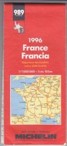
A 1 in 1 million scale map
To set the Golden Owl puzzle Max used the Michelin 989 map published in 1993, at a scale of 1 in 1 million. The number 989 is no longer available, though the new Michelin 721 is the same scale. It is often possible to find old copies of the 989 map on eBay, and they can be downloaded online see this French site for details.
We know that this is the right map and scale for a few reasons. The enigma 500 mentions the scale with the line, “560,606 measurements, it is far. But the mega is a million times less.” This suggests the scale and the use of a much more detailed map for the ‘mega solution’ final stage.
The maker of the map was confirmed by a Supplementary Indication, which speaks of something, “inflated and his opinions hold the road”, that is, to say the famous Michelin Man. The Michelin brand was also clearly stated in a press article published in 1994.
A few things worth knowing about the maps. ‘Ronceveaux‘ is the answer to the 470 enigma but some later versions of the Michelin map use the Basque name for this town Orreaga.
The ‘precise’ map
The second map is the most accurate one possible. Max always refused to indicate the brand, it is most likely an IGN 1: 25000 map, or perhaps a local unbranded tourist map. He said, “The precise map is the one that is the most common!”
The first map is used to pinpoint an area about the size of a town, then you switch to a precise map to find the exact location of the treasure.
Other useful maps
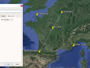
It is widely accepted that solving this treasure hunt needs lines drawn on the map and/or towns plotted or marked. Many people use Google map or Google Earth Pro which is a free downloadable map program with many useful features. You can use this to stick ‘pins’ or trace lines and measure distances. It also has historic satellite imagery so it’s possible to see how locations have changed since the owl was buried more than twenty years ago. It’s my understanding that Google measures distance ‘on the ground’ so a mountaineous region would show as many more kilometre than a flat area, it’s a useful tool but worth considering that the Michelin map will plot things differently. If you decide that enigma 500 involves a 185km distance this is a simple 18.5cm of distance on the paper map, but it might reach a slightly diffent location than 185km measured by Google. It’s up to each individual owl hunter how much they think this may matter!
There is also free software designed by owl hunting enthusiasts. Gribouillot is a Map Annotation tool created by Ludovic A. It allows the plotting of owl specific things such as spirals. It can be used with a downloaded version of the original 989 map.